
Loch Lomond Tour Example
This consists of 6hrs 49 mins driving time and comes to 269 miles for the day.
This route would take you via Lochearnhead, Aberfoyle, , Loch Lomond and the Trossachs National Park, Killin and Loch Tummel.
We suggest at least three breaks during the day, one of which for lunch.
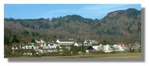
Lochearnhead is situated at the western end of Loch Earn, a gently lapping Highland loch dramatically edged by mountains at the western edge of Strathearn.
The village services the large numbers of visitors who come to the loch which is a popular centre for fishing and a wide range of watersports including sailing, water-skiing, wake-boarding and canoeing.
The remains of a crannog, an ancient loch dwelling, can be found at the south west corner of the Loch Earn. This highlights that there has been a settlement here for the last two thousand years.

Aberfoyle
Aberfoyle is a charming village on the banks of the River Forth in the magnificent Queen Elizabeth Forest Park.
Aberfoyle is a popular holiday village with an attractive main street and well served with individual shops, cafés and restaurants. Learn more about the area’s natural beauty and history at the Trossachs Discovery Centre. The Scottish Wool Centre relates the full story of wool, from sheep to the shops, through live sheep shows and hands-on demonstrations of spinning and working sheepdogs.
Loch Lomond and the Trossachs Park The National Park encompasses around 720 sq miles (1,865 sq km) of some of the finest scenery in Scotland and is split into four distinct areas. It is a place of contrasts from rolling lowland landscapes in the south to high mountains in the north, and has many lochs and rivers, forests and woodlands. It is also a living, working landscape which has been influenced by people for generations and is visited and enjoyed by many for its recreational value.
The Loch Lomond & The Trossachs National Park became fully operational on 19 July 2002 and was officially opened by Princess Anne on 24 July 2002.
Key Facts
- The Park is 1,865 sq km (720 sq miles) and has a boundary length of 350km (220miles).
- 50% of Scotland’s population lives within an hour’s drive of the National Park.
- There are 21 Munros (mountains above 3,000ft) in the Park and the highest is Ben More at 1,174m.
- There are 19 Corbetts (mountains between 2,500ft and 3,000ft).
- There are 22 larger lochs, with numerous smaller lochs and lochans.
- About 50 rivers and large burns.
- 15,168 people live in the National Park (2011 census).
- There are two Forest Parks – Queen Elizabeth in the Trossachs and Argyll in Cowal.
- Ben Lomond National Memorial Park is Scotland’s national memorial to those who have died in conflict. Find out more at www.nts.org.uk

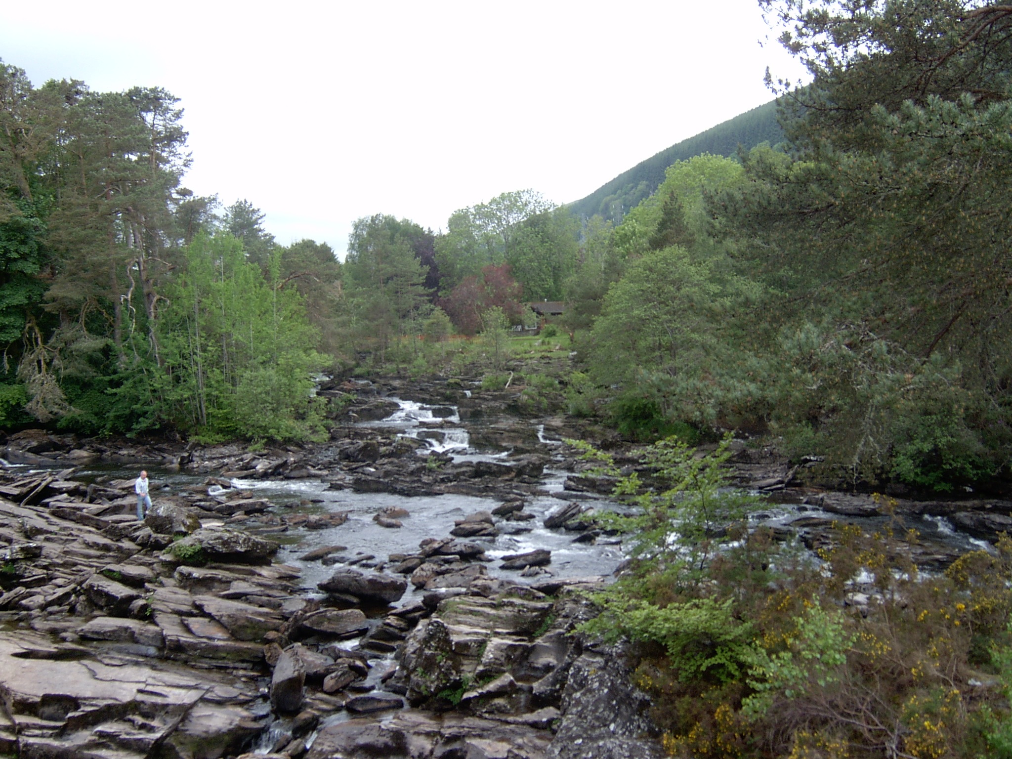
Killin
Killin lies at the centre of the area known as Breadalbane (Gaelic Bràghad Albainn meaning ‘the high ground of Scotland’) and the hills of the Tarmachan Ridge and Lawers Range can be seen clearly from the main street of the village. What Killin is most noted for, however, are the Falls of Dochart, where the River Dochart tumbles into the heart of the village beneath the Dochart Bridge. As a tourist village, it is somewhat ironic that the worse the weather, the more dramatic the main tourist attraction becomes!As the point at which two east-west glens, Dochart and Lochay, converge upon the natural transport route of Loch Tay, Killin was a natural place for a community to develop and it became home to a variety of trades such as weavers, tailors, blacksmiths and masons. The coming of the railway in 1888 changed the nature of the village, opening it up to tourism. The railway is no longer here but Killin’s economy still depends to a large part on tourism.Killin’s location, at the edge of the Ben Lawers National Nature Reserve and the Loch Lomond and Trossachs National Park, is ideal for lovers of nature and the outdoors. Wildlife abounds in the area and Ben Lawers is noted for its alpine and arctic flora.
Loch Tummel
Loch Tummel is a long narrow loch in Perthshire, 6 miles (9.6 km) west of Pitlochry.
The area around the River Tummel and Loch Tummel is known as Strathtummel and is one of the most beautiful parts of Perthshire’s ‘Big Tree Country’, with ever changing colours throughout the seasons and a great choice of walks, cycle routes and places to relax.
Set high above Loch Tummel is the Queens View, one of the most famous viewpoints in Scotland. The panorama west to the peak of Schiehallion and Rannoch Moor is breathtaking and the viewpoint can be accessed throughout the year, thanks to a nearby Forestry Commission car park and well maintained footpath. Visitors can also enjoy the facilities at the Queens View Visitor Centre, which is a focal point for the Tay Forest Park and has an excellent audio-visual film, tearoom, forest shop and toilets.
There are a number of Forestry Commission waymarked walking and cycling routes through Allean Forest on the hillside, just west of the Queens View. The trails provide magnificent views of Loch Tummel and the surrounding countryside, with plenty of historical and wildlife interest along the way.
To get closer to the loch, a leisurely cycle along the quiet, scenic south shore road is worthwhile.
Please feel free to use the link below to submit an inquiry or call 0044 7446112672 to discuss your requirements